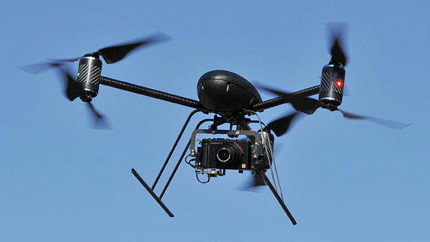
Our UAV has a 5.8 GHz one-way, helicopter to ground video link. The video
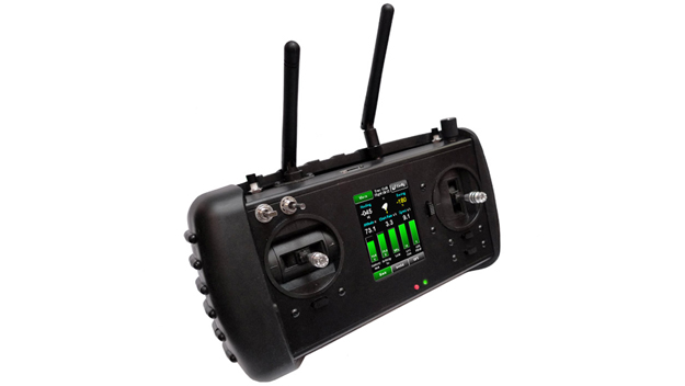
 data transmitted by the Draganflyer X6 UAV is captured by a dual-diversity wireless video receiver, which is embedded in the handheld computerized
controller.
data transmitted by the Draganflyer X6 UAV is captured by a dual-diversity wireless video receiver, which is embedded in the handheld computerized
controller.
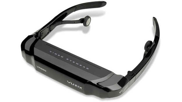
The controller features two video output jacks that relay the live-video data to a pair of video glasses. This provides the pilot of the UAV with a bird's eye view of
the surrounding area and at the same time allows our customers to follow the UAV camera's real-time view. Our customers hereby have the unique ability to choose their
own perfect shot of what they wish to have captured on photo or video.
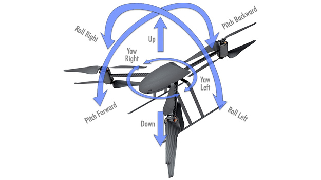
For outdoor operations, a vital sensor system of the UAV is its on-board GPS
 (Global Positioning System). The GPS system is able to track 16 satellites simultaneously and provides the UAV with a position hold function, allowing it to
maintain a geographic fix and at the same time ascend or descend vertically while the camera is being operated.
(Global Positioning System). The GPS system is able to track 16 satellites simultaneously and provides the UAV with a position hold function, allowing it to
maintain a geographic fix and at the same time ascend or descend vertically while the camera is being operated.
GPS data is also sent to the controller, which, amongst other things, provides the display screen with real-time information relative to the latitude, longitude, altitude, as well as the quality and
overall accuracy of the captured GPS signal.
|